
Remote sensing has become a very treasured tool in monitoring, evaluation, and management of a variety of resources throughout the world. It has enormous applications ranging from Agriculture, Geology, Surveying, Hydrology, Forestry, Strategic, Weather, Positioning, Ecology, Oceanography, Glaciology and many more. In these applications of satellite based remote sensing, the innovations and advancements in technologies are important factors that need to be explored. In this context, Short Term Course (STC) on Remote Sensing and its Applications was organized by Human Resource Development Center & Centre for Space Research, Division of Research and Development, Lovely Professional University w.e.f. 31 Jan. 2022 to 04 Feb. 2022. The Course was instrumental in capacity building on science and engineering of remote sensing, application of remote sensing, digital image processing for remote sensing and GPS & Indian Regional Navigation Satellite System (IRNSS).
Dr. Brijendra Pateriya, Director, Punjab Remote Sensing Center, (PRSC) Ludhiana, National Vice President-II, Indian Society of Remote Sensing (ISRS), in his Chief Guest address emphasized the need of studying remote sensors which can serve as major sources of data on the effects of human behavior within the biosphere, enabling the establishment of the spatial scale and extent of the direct interaction of humans with the global land cover. He congratulated the organizing team for organizing program on an agenda of Satellite remote sensing and sensors, Digital image processing techniques for remote sensing Image interpretation and analysis, GPS & Indian Regional Navigation Satellite System (IRNSS) and applauded the participants for showing keen interest in upskilling themselves in futuristic thrust area of remote sensing.
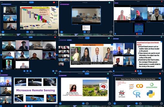
The program was conducted by seasoned Subject Matter Experts from scientists of ISRO, IARI, IIRS, PRSC, IITs and MNITs and academicians of high repute. DVA Raghava Murthy, Advisor, Centre for Space Research, LPU, Former Director, Earth Observations System, ISRO Hq., India ; Dr. Nagaraja Ravoori, DST Geospatial Chair Professor, IIITH, former Chief General Manager, Reginal Centres, National Remote Sensing Centre (NRSC) ISRO; Dr. R.K Setia, Scientist E, Punjab Remote Sensing Center (PRSC) Ludhiana; Dr. Vandana Chabra, Assistant Professor, Department of Agronomy School of Agriculture, LPU; Dr. Prakash Singh Tanwar, Associate Professor, School of Electronics and Electrical Engineering, LPU Punjab; Dr Markand Oza, former Scientist & Head , SAC, ISR, Content Generation and Data Dissemination (Division of VEDAS); Mr. Harpinder Singh Scientist D, Punjab Remote Sensing Center(PRSC), Ludhiana,; Prof. A.K. Saraf, Professor, Dept. of Earth Sciences, Indian Institutes of Technology (IIT), Roorkee ; Dr Kuldeep Singh, Assistant Professor, Dept. of ECE, Malaviya National Institute of Technology (MNIT), Jaipur; Dr. Shallu Sharma, Scientist, NINS Lab, National Brain Research Centre (NBRC), Manesar, Gurugram; Dr. Anamika Singh, Research Associate, Centre for Environment Science and Climate Resilient Agriculture (CESCRA), Indian Agricultural Research Institute (IARI), New Delhi; Dr. Sharad Gupta, Scientist C, Punjab Remote Sensing Center(PRSC), Ludhiana, Punjab; Dr. N. Subash, Principal Scientist, ICAR-Indian Institute of Farming Systems Research , Modipuram, Meerut,; Dr. Joydeep Mukherjee Principal Scientist Indian Agriculture Research Institue (IARI), New Delhi; Dr. SVC Kameswararao, Professor and Ex-Director, Former Scientist G, Regional Remote Sensing Centre (RRSC/NRSC/ISRO), Nagpur, they focused on importance of remote sensing and its application in allied areas, role of remote sensing in the strategic development of India in varied fields, role of Indian Remote sensing programs in different sectors: agriculture, town planning, forestry, observing climate changes, study of biodiversity, satellite remote sensing and sensors, satellite remote sensing data format, spatial and temporal data analysis, Digital Image Processing (DIP) techniques for Remote Sensing, Image Rectification and enhancement for Remote Sensing, QGIS software, Hyperspectral Image interpretation and analysis, remote sensing in Mapping & Cartography and emerging trends in the field of remote sensing.
In the valedictory address, Chief Guest Dr. SVC Kameswararao, Professor and Ex-Director, Former Scientist G, Regional Remote Sensing Centre (RRSC/NRSC/ISRO), Nagpur revealed the opportunity to upgrade career in remote sensing with new aspects. He emphasised the need of starting industry-oriented courses and opening some platforms for entrepreneurs to learn about emerging technologies in remote sensing. He extended his sincere congratulations to the organizing team of Lovely Professional University for organizing the Short Term Course on Remote Sensing and its Applications.
Prof. DVA Raghava Murthy, Advisor CSR, LPU, Former Director, Earth Observations System, ISRO appreciated the Organizing committee, Resource Panel and the participants for working together on a futuristic agenda of remote sensing. He thanked the Chief Guest, and eminent Resource Panel.
The program convener Dr. Monica Gulati, Professor & Executive Dean Division of Research and Development, LPU, emphasized that the Short Term Courses organized as outreach training programs are envisioned to upskill participants of Lovely Professional University and public at large and this course was successful in meeting the said objectives. She also acknowledged the valuable contribution of the intellectual capital and appreciated the organizing team for organizing a meaningful workshop, successful in meeting participants’ expectations.
Program Co –Convener, Dr. Sumit Kumar, Associate Professor, Centre for Space Research CSR-DRD, Lovely Professional University and program coordinators Dr. Savita Gupta, Professor and Head –Dept. of Faculty Development, HRDC, Dr. Daljeet Singh, Assistant Professor, Centre for Space Research, Division of Research and Development, LPU, Dr. Jai Sukh Paul Singh, Assistant Professor Centre for Space Research, Division of Research and Development coordinated the workshop maintaining great connect with the participants and Resource Panel.
The Co-Convener of the program Dr. Sumit Kumar, Associate Professor, Centre for Space Research CSR-DRD, Lovely Professional University presented the Program Report by sharing the ‘THINK BIG’ vision of Lovely Professional University which empowered them to organize the Short Term Course on Remote Sensing and its Applications and congratulated the participants for successful completion of the program.


